File:RTS-map 95.jpg
Size of this preview: 693 × 600 pixels. Other resolution: 952 × 824 pixels.
Original file (952 × 824 pixels, file size: 283 KB, MIME type: image/jpeg)
Summary
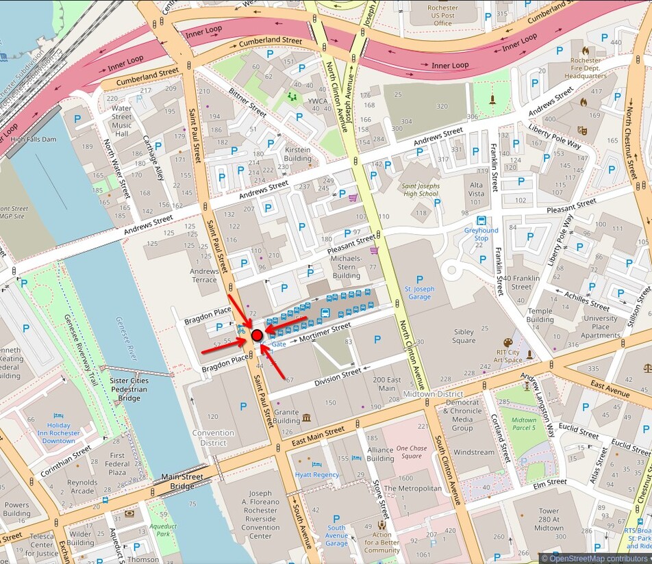
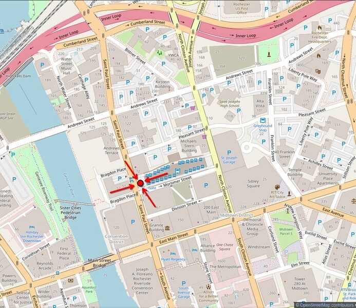
A map showing the area surrounding the Rochester Transit center. A red dot is placed at the St. Paul Street entrance with four red arrows pointing to it.
File history
Click on a date/time to view the file as it appeared at that time.
| Date/Time | Thumbnail | Dimensions | User | Comment | |
|---|---|---|---|---|---|
| current | 11:06, 7 June 2025 | | 952 × 824 (283 KB) | Scott (talk | contribs) | A map showing the area surrounding the Rochester Transit center. A red dot is placed at the St. Paul Street entrance with four red arrows pointing to it. |
You cannot overwrite this file.
File usage
The following page uses this file: